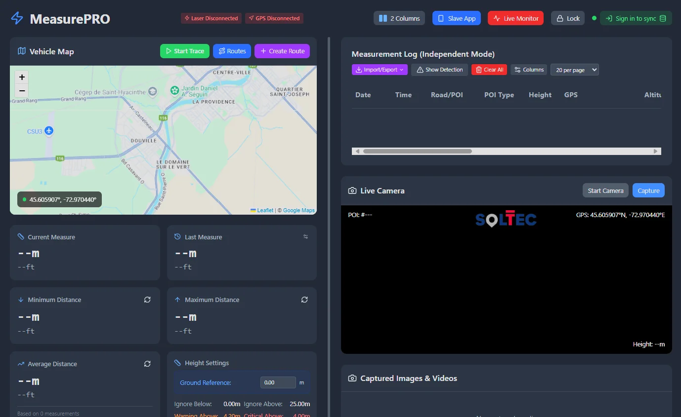
MeasurePRO Features

LiDAR Route Survey System for Oversize & Heavy Haul

Field-verified route intelligence at highway speed.

SolTec Innovation's global field-capture system gives organizations that perform their own LiDAR route surveys verified intelligence for heavy haul, exceptional transport and out-of-gauge (OOG) movements.

Measure the Route

Connected measurement, positioning and visual evidence for route feasibility.

LiDAR Measurement

The SolTec 2D LiDAR captures field measurements with ±2 mm accuracy across a 0.2–250 m range. Its Class 1 eyesafe laser and IP67-rated housing support repeatable route reconnaissance in active field conditions.

  • Real-time measurement capture
  • Metric and imperial units
  • Ground-reference adjustment

Overhead Clearance Capture

Measure bridges, utility lines, signs, vegetation and other overhead constraints from the survey vehicle for route-feasibility and corridor-assessment work.

  • Vertical clearance records
  • Location-linked evidence
  • Highway-speed field capture

Route Constraint / POI Capture

Record and categorize points of interest and constraints encountered along an oversize/overweight, abnormal-load or project-cargo route.

  • Categorized POIs
  • Notes and measurements
  • Photo/video association

GPS/GNSS/RTK Positioning

Dual-GPS/GNSS positioning associates measurements and evidence with route coordinates, with support for professional GNSS/RTK receivers.

  • NMEA positioning
  • Swift Navigation Duro support
  • Windows location fallback

360° Visual Evidence

Synchronized camera evidence provides visual context for every route constraint, including GPS-tagged photos and geo-referenced video.

  • Photo and video capture
  • EXIF GPS metadata
  • Geo-referenced playback

Voice / Hands-Free Workflow

Use voice commands in English, French or Spanish while surveying. Commands require internet connectivity; voice notes remain available offline.

  • EN / FR / ES commands
  • Hands-free capture controls
  • Offline voice notes

Field System & Data Workflow

A native Windows field system built around survey hardware, offline work and interoperable delivery.

Offline Field Operation

Native Windows 10/11 (64-bit) application on a rugged tablet. The delivered field system works fully offline so survey work can continue beyond cellular coverage.

Field Data & Survey Management

Create surveys, organize project information, manage POIs and preserve measurement, position, note and media records together.

RoadScope Synchronization

When connectivity returns, survey data can synchronize to RoadScope for the next stage of route intelligence and collaboration.

Hardware Integration

Native COM/serial, USB and Ethernet connectivity supports SolTec LiDAR, Jenoptik LDS-30 and Swift Navigation Duro GNSS hardware.

Export & Interoperability

Deliver field records in CSV, JSON, GeoJSON, KML or ZIP formats for GIS, engineering, reporting and project workflows.

Weather-Resilient Filtering

Measurement filtering helps reject rain, snow and atmospheric noise, with signal-quality information available to the operator.

Specialized Measurement Modes

Purpose-built modes support bridge surveys, lane width, signal spacing and railroad overhead-clearance measurements.

Survey-Team Monitoring

Multi-device and live-monitoring capabilities help survey teams coordinate field capture and observe measurements, position and camera evidence.

Multilingual Voice Commands

Field teams can control common capture actions and request system information in English, French and Spanish. Internet connectivity is required to process commands; recording voice notes works offline.

English — “capture image”
Français — « capturer une image »
Español — “capturar imagen”

Continue the Workflow with the SolTec Ecosystem

MeasurePRO owns the MEASURE IT. stage of “One Route. One Truth.” RoadScope, ProfilingPRO, SweptPRO, LoadPRO, SolTecONE and ConvoyGuardian are separate products—not MeasurePRO add-ons.

MEASURE IT.

MeasurePRO captures verified measurements and route evidence; ProfilingPRO is a separate field-capture product.

MAP IT.

RoadScope organizes route intelligence; SweptPRO and LoadPRO provide separate analysis capabilities.

MOVE IT.

SolTecONE and ConvoyGuardian support route execution as separate ecosystem products.

PROVE IT.

Reports and permits carry the evidence chain into project deliverables.

See MeasurePRO on the Road

Evaluate the complete, quote-based hardware and software package for your own route-survey operation.

Prefer SolTec to perform the route survey for you? SolTec Consultant can execute the work.